
Real-Time Crop Growth Monitoring and Yield Prediction Using Drones, mobile networks, and Cloud Analytics
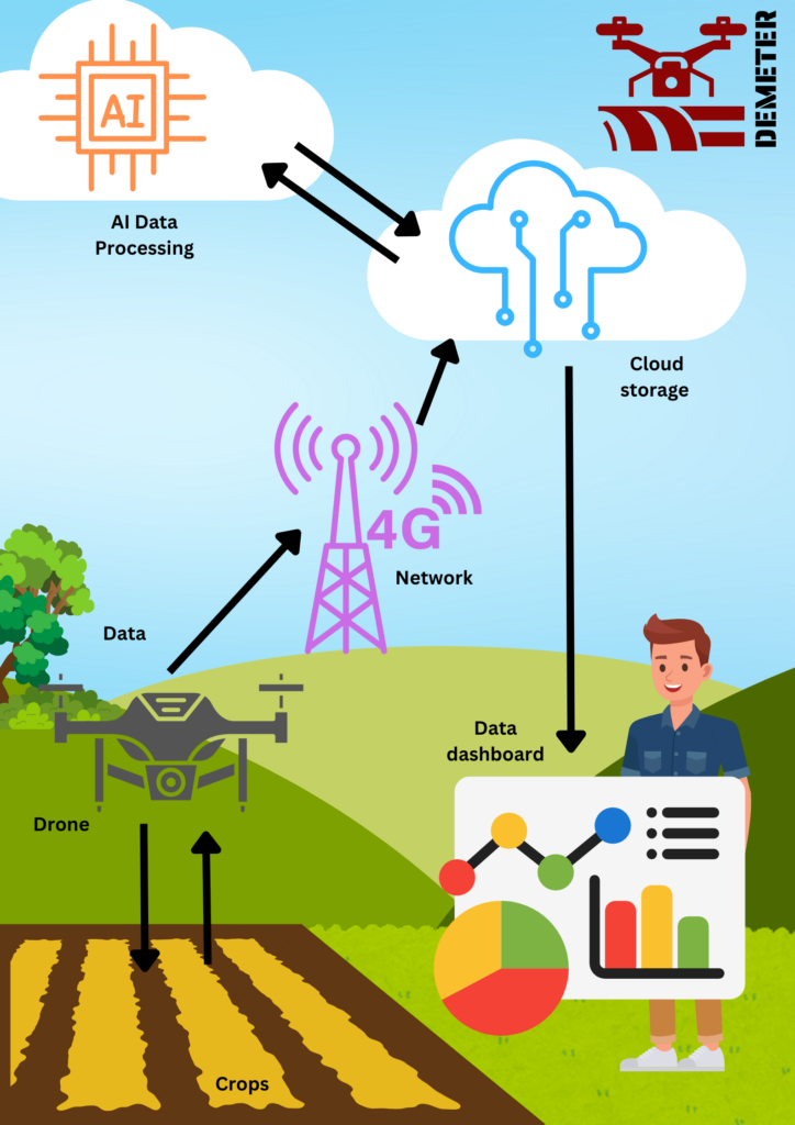
This use case will develop a data-driven crop growth monitoring system based on unmanned aerial vehicles (drones). The crop growth monitoring will encompass periodic measurements of canopy cover, leaf area index and proxies of chlorophyll intensity which will be used to calibrate process-based crop growth models. This will enable the prediction of total light absorption by grown crops, their photosynthetic output and projections of total economic yield. The predictions are fed into what-if analyses and decision support systems that enable farmers to plan field activities and manage productivity expectations conditioned on crop growth. One of the main barriers to the development of systems like this is the lack of reliable rural wireless data networks.
The DEMETER use case will develop and demonstrate a crop health and yield prediction workflow (with Wheat and Potato as model crops), leveraging mobile networks to provide and end-to-end service from drone image collection to insight reports within the field. The project will feature an interface that allows the upload of drone sensor data to the cloud, where an ensemble predictive models will generate insights from the data and send them back to the end user via an analytics dashboard.
The project is named “Demeter” after the Ancient Greek goddess of the harvest, symbolizing our focus on agricultural productivity and crop growth monitoring through advanced technologies.
Further Reading:
Boursianis, A.D., Papadopoulou, M.S., Diamantoulakis, P., Liopa-Tsakalidi, A., Barouchas, P., Salahas, G., Karagiannidis, G., Wan, S. and Goudos, S.K., 2022. Internet of things (IoT) and agricultural unmanned aerial vehicles (UAVs) in smart farming: A comprehensive review. Internet of Things, 18, p.100187.
Mhango, J.K., Harris, E.W., Green, R. and Monaghan, J.M., 2021. Mapping potato plant density variation using aerial imagery and deep learning techniques for precision agriculture. Remote Sensing, 13(14), p.2705.